My friend Dr. Dustin Garrick has a wonderful initiative called Water Cycles Expeditions, which is a “social mission focussing on inspiring a global movement to reconnect people and water through cycling”. Dustin and I met earlier this year through our mutual passions of cycling and water.
I’ve been exploring by bicycle for many years and I’ve been on bike rides that have focussed on the water systems near my home (even before meeting Dustin!)
This article first appeared on my cycling blog (www.ridecyclespin.com) back in 2016 and I’ve added a map and some text. On the bike ride described below, I recruited a few friends to help achieve a cycling goal of crossing as many bridges over the Grand River as we could (within a reasonable cycling distance). As it turned out, I encountered 12 bridges that day; 11 of which were crossable. The original blog post (found here) included only descriptions of the bridges, so I’ve added some descriptions of the water below. And here’s a map of the 12 bridges:
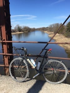
Bridge 1: This photo is looking downstream, to the south. Just downstream from this bridge, one of the main tributaries of the Grand River - the Conestogo River - converges with the Grand River.
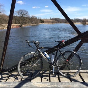
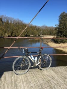
Bridge 2: Peel St., Winterbourne, ON. A nice old iron bridge that doesn't see much car traffic (Note: This bridge was later closed to car traffic and as of a few years ago, was completely closed to bikes, pedestrians…). The Grand River in Winterbourne flows south towards Conestogo. The photo is looking upstream, to the north.
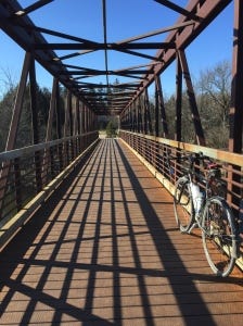
Bridge 3: Wobbly, bumpy farmer’s bridge on Crooks Tract Rd/Buggy Lane. This spot is just north of Winterbourne and south of West Montrose. This is now a private bridge, so cyclists are not allowed.
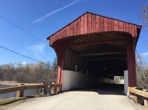
Bridge 4: The famous covered bridge in West Montrose. Flooding can be an issue in the village of West Montrose. A campground and some of the homes lie within the floodplain.
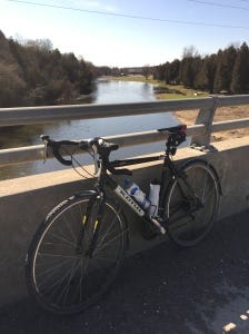
Bridge 5:Just north of West Montrose, Highway 86 crosses the Grand River.
Bridge 6: Weisenberg Road was a regular route on our club Gravel Grinder rides until a few years ago when it was completely sealed off to everyone. There’s an advocacy group trying to get it open for pedestrians and cyclists once the safety issues are worked out. This photo is looking upstream, to the north.
Bridge 7: At 8th line, a newer bridge crosses the Grand River near Pilkington lookout. This photo is looking towards the south, downstream.
Bridge 8: A low-lying bridge in Elora Gorge Conservation Area. We didn’t cross this bridge for fear of being washed away downstream. Our ride in 2016 was in the spring and the river was flowing fast.
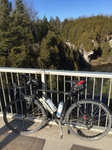
Bridge 9: Also in Elora Gorge Conservation Area, there’s a high bridge over the Elora Gorge. The Grand River cuts through the bedrock in this area and the Elora Gorge is surprisingly high.
Bridge 10: Wellington Rd 7. This photo is looking north to where Irvine Creek converges with the Grand River. The Elora Gorge in this area is quite spectacular. In summer, Irvine Creek is barely a trickle, but in spring (after snowmelt) and after high rainfall events, Irvine Creek can carry a lot of water.
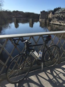
Bridge 11: Metcalfe St., Elora, ON, with the Elora Mill in the background. This photo is looking downstream, towards the south. Just out of this photo is a nice water falls where there’s a small power-generating station.
Bridge 12: Elora, Ontario (and Fergus, which is just upstream) is a beautiful little village centered around the Grand River.
I’ll be cycle touring more areas of the Grand River and documenting my rides and I’ll be posting articles on my travels! On my cycling blog, I have explored another Water Cycles ride where I crossed the Conestogo River many times in 2016.


