


Watersheds in Southern Ontario - Part 2

In a continuation of my watershed series, I’ve drawn (using open-source software, QGIS) three more watersheds and stream networks in Southern Ontario.
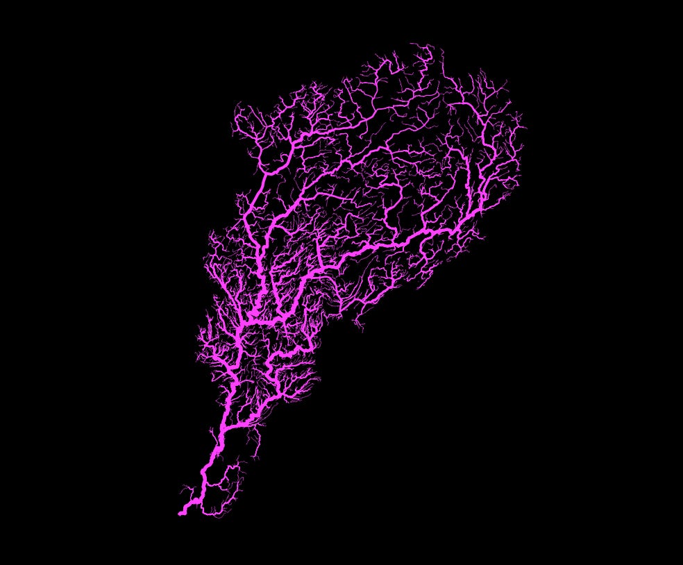
In this first watershed, the Sauble River flows from the east to the west before discharging in the northwest corner of the watershed at Southampton. Headwaters start in the east near the small towns of Markdale, Proton Station (great name!), and Kingscote, and from the south around towns of Teeswater and Mildmay.

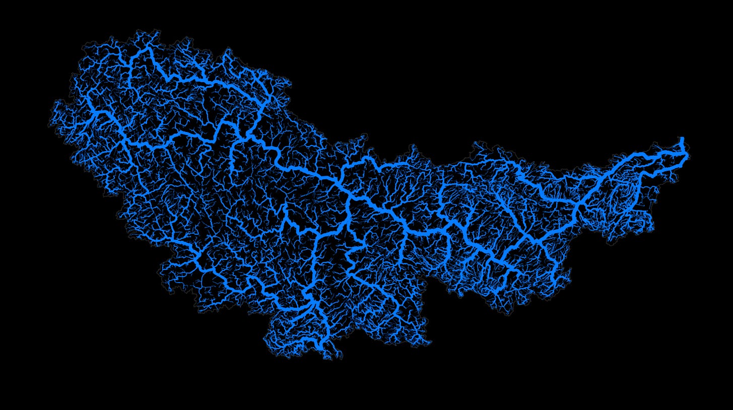
The second watershed in this article is the Madawaska River watershed, seen below. The Madawaska River starts up in Algonquin Park and flows west to east before discharging its water into the Ottawa River in Arnprior. This watershed includes most of the panhandle of Algonquin Park. The river itself is about 230 kilometres long and the watershed covers an area of over 8,000 square kilometres.
The third and final watershed for this article is Burnt River watershed. The main branch of the Burnt River starts at Miskwabi Lake in the Haliburton Highlands. north of the main branch, the Drag River, which has headwaters around Drag Lake, flows through the village of Haliburton and continues south until converging with the Burnt River near Gelert and Milburn Roads. The other main tributary is the Irondale River, which flows northeast to southwest before converging with the Burnt River, just north of Kinmount. The Burnt River then continues on its southbound journey, through a tiny community called … Burnt River, on its way to Cameron Lake, where it discharges and becomes part of the water in the Trent-Severn Canal system.
Drawing these maps has helped me learn about the beautiful watersheds on Ontario. If you have a specfic request or a favourite watershed, water-drop it in the comments below and I’ll draw it up!
Thanks for reading the Water Droplet! Stay tuned for more interesting articles on water. To get email notifications of new articles, sign up here:
I don't want to sound greedy but there are 3 rivers I'd like to see. The Grand River, the Mississippi River and the Tay River. Thanks
How about the Grand ;)