


Watersheds of North America - Part 7

Since late 2024, I’ve been using open-source software (QGIS) to visualize open-source hydrology data. This has allowed me to create maps of networks of streams to represent watersheds. This article is part 7 in an on-going series of articles where I present these visualizations.
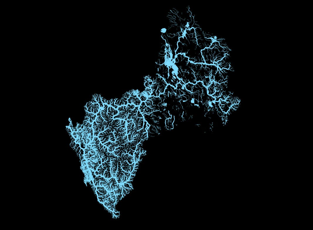
The watershed in this article is that of the Klamath River. The river system starts in the state of Oregon and flows south and east through northern California to the Pacific Ocean.
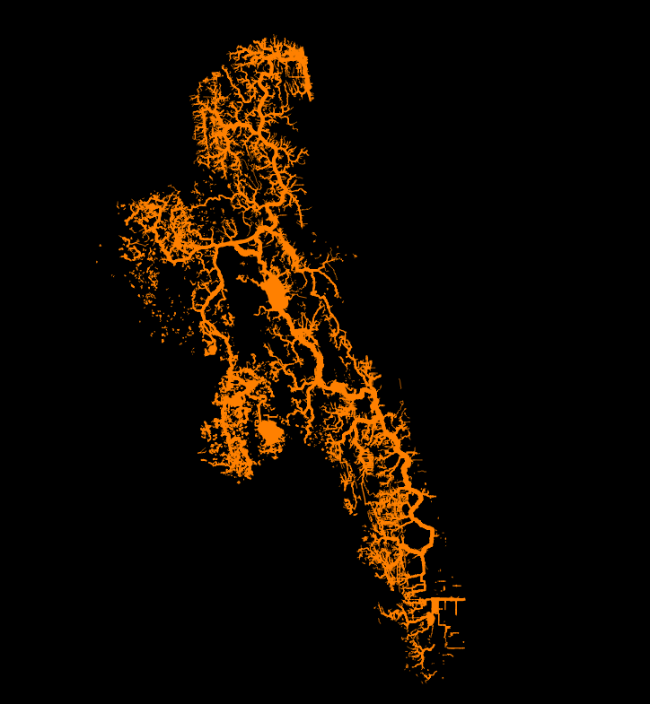
The second watershed is of the St. Johns River in Florida. The main branch of this river starts in the wetland areas near Vero Beach, Florida (north of Miami). The river flows south to north and discharges into the Atlantic Ocean near Jacksonville, Florida. We also find headwaters southwest of Jacksonville, in central Florida, around Gainesville and west of Orlando.
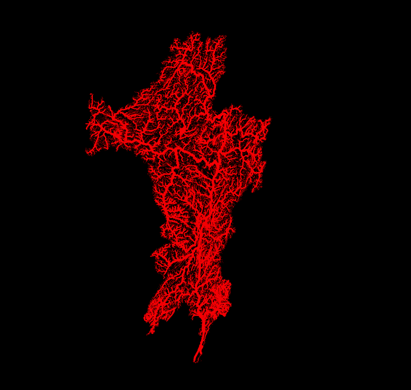
The third watershed is that of the Hudson River in New York state. The headwaters of the Hudson River lie in the Adirondack mountains, southeast of Lake Ontario and south west of Lake Champlain. The river flows north to south through Albany, Poughkeepsie and New York City. The Hudson River flows past Manhattan Island and Long Island before discharging into the Atlantic Ocean near Coney Island, New York.
If you have a specific request or a favourite watershed, feel free to leave a comment below and I’ll draw it up! The watersheds in my articles have been popular with readers and I’m thinking about creating wall art watersheds. Let me know if you are interested.
Thanks for reading the Water Droplet! Stay tuned for more interesting articles on water. To get email notifications of new articles, subscribe here:
Columbia, Snake
Hi Steve! I would love wall art focused on the 5 boroughs in New York City :)