


Watersheds of the World - Part 9

Since late 2024, I’ve been using open-source software (QGIS) to visualize open-source hydrology data. This has allowed me to create maps of networks of streams to represent watersheds. This article is part of an on-going series where I present these visualizations.
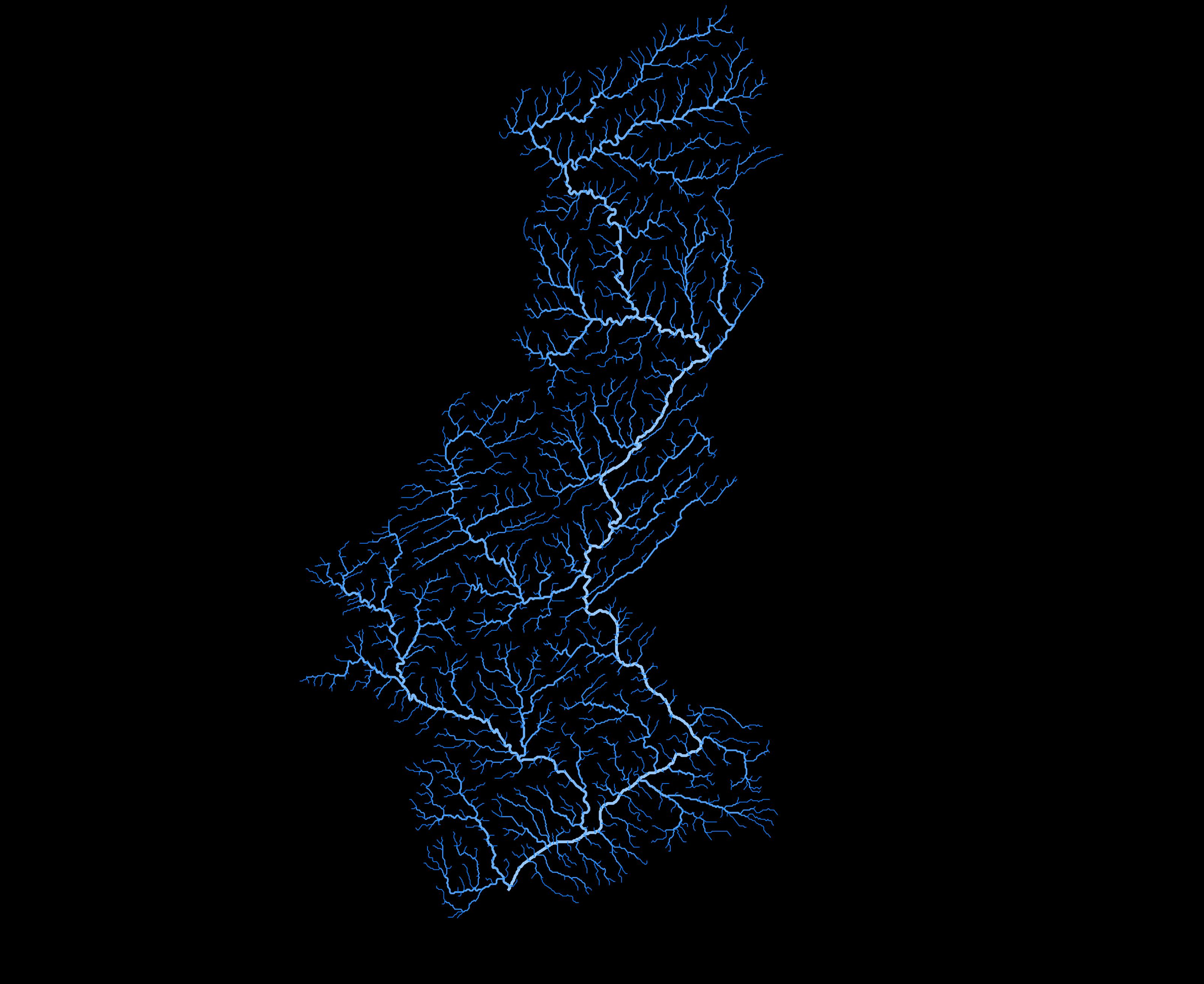
I recently received a request to show the watershed for the Delaware River, which flows north to south, with headwaters in New York state in the Catskill Mountains. The river continues through Pennsylvania, including the cities of Allentown and Philadelphia, as well as Trenton, New Jersey, before discharging into the Atlantic Ocean at Delaware Bay.
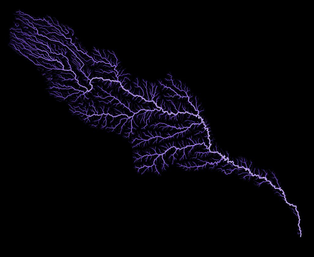
The second river is the “other” Colorado River. I only learned about this river earlier this month. The more-famous Colorado River flows through the states of Wyoming, Colorado, Utah, Arizona, Nevada and California and flows into Mexico and into the Gulf of California.
This “other” Colorado River, shown below, is the fifth longest river in the state of Texas at nearly 1,400 kilometres (860 miles). It has headwaters in southeastern New Mexico and flows southeast before discharging into the Gulf of Mexico, just south of Houston. The watershed of the Colorado River of Texas reminds me of a feather.
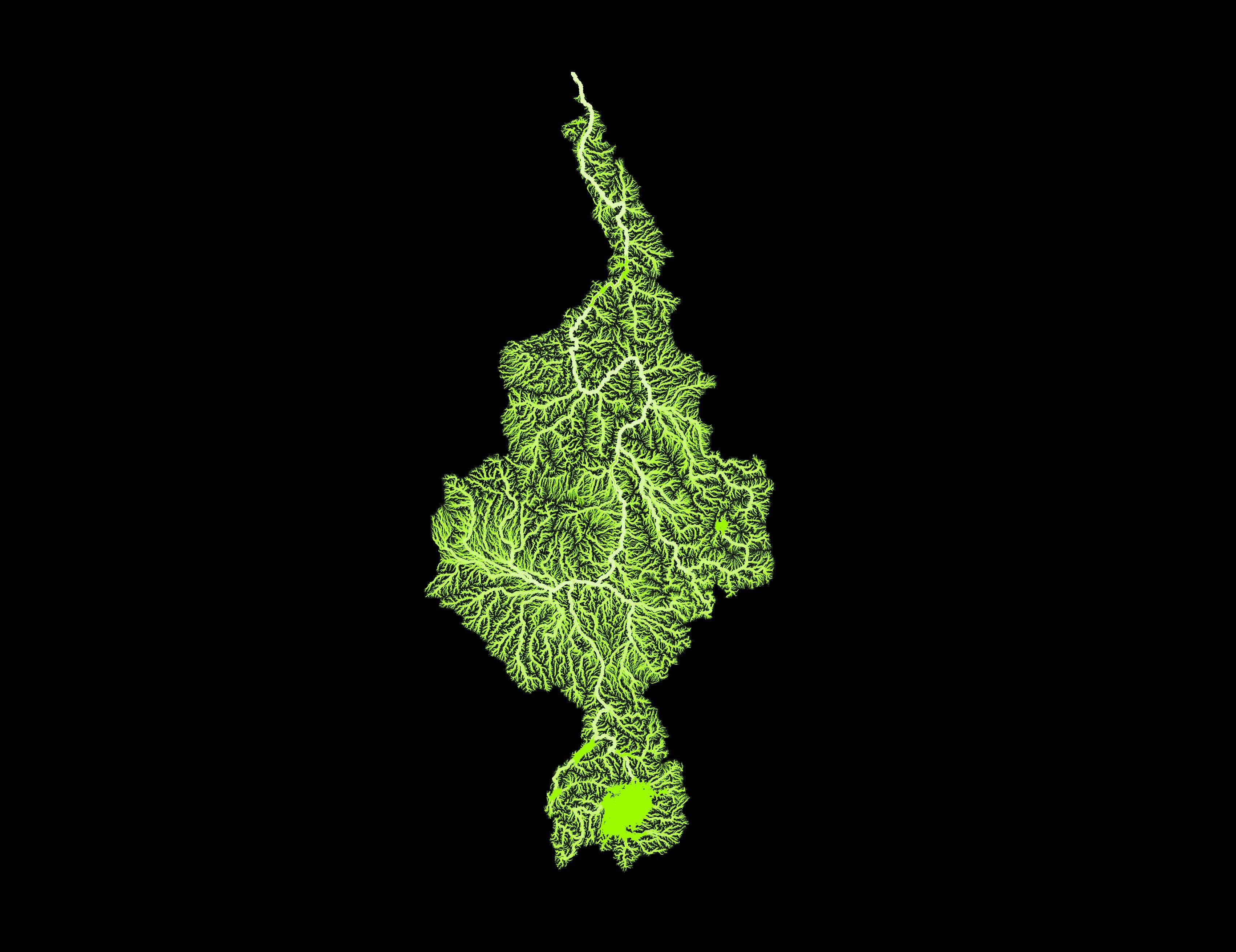
The final watershed, shown below, is that of the Nile River in Africa. The river flows south to north, from the countries of Tanzania, Burundi, Rwanda, Kenya and Uganda. The Nile outflows from Lake Victoria. The river continues northward through South Sudan, Sudan and finally Egypt before flowing into the Mediterranean Sea north of Cairo. The watershed also covers parts of the Democratic Republic of the Congo, Ethiopia and Eritrea.
At over 6,600 kilometres (4,100 miles) in length, the Nile is the longest river in the world and the watershed covers an area of approximately 2,870,000 square kilometers, or about 10% of Africa. Over 200 million people live within the watershed.
And maybe it’s the colour I used below, but I think the watershed looks like the Dr. Seuss character, the Grinch!
Thanks for reading the Water Droplet! Stay tuned for more interesting articles on water. To get email notifications of new articles, subscribe here:
Hit “Share” below if you want to share the Water Droplet!
Grasshopper Geography has been making art prints based on this concept for several years - I asked for (and received!) the one of Canada a few years ago. It’s enrapturing! https://www.grasshoppergeography.com/products/river-basin-map-of-canada-with-black-background-fine-art-print
Fractal patterns like these underscores the randomness of the universe.