


Groundwater in California
Depletion of groundwater in Central Valley

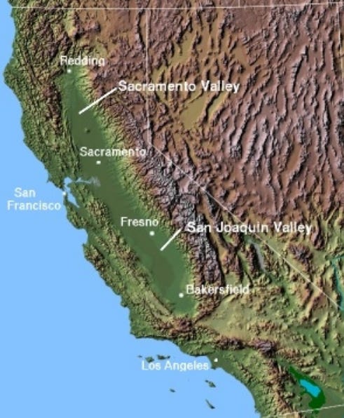
Central Valley in California covers approximately 20,000 square miles (about 52,000 square kilometres). The valley is relatively flat and is between 60 to 100 kilometres wide and 720 kilometres long. It extends from Redding, California in the north to south of Bakersfield, California in the south. Central Valley is subdivided into two valleys: The Sacramento Valley in the north and the San Joaquin Valley in the south (the latter of which is further subdivided into the San Joaquin Basin and Tulare Basin.
If we look at a ground surface elevation map, we can see the immense “bathtub” of the Sacramento and San Joaquin Valleys below.
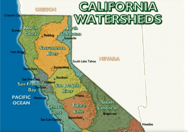
The watersheds are shown below. The area of the watersheds of Central Valley is about three times large than the valley itself. The only natural outlet for the valley is via the Carquinez Strait that is part of the tidal estuary of the delta of the Sacramento and San Joaquin Rivers.
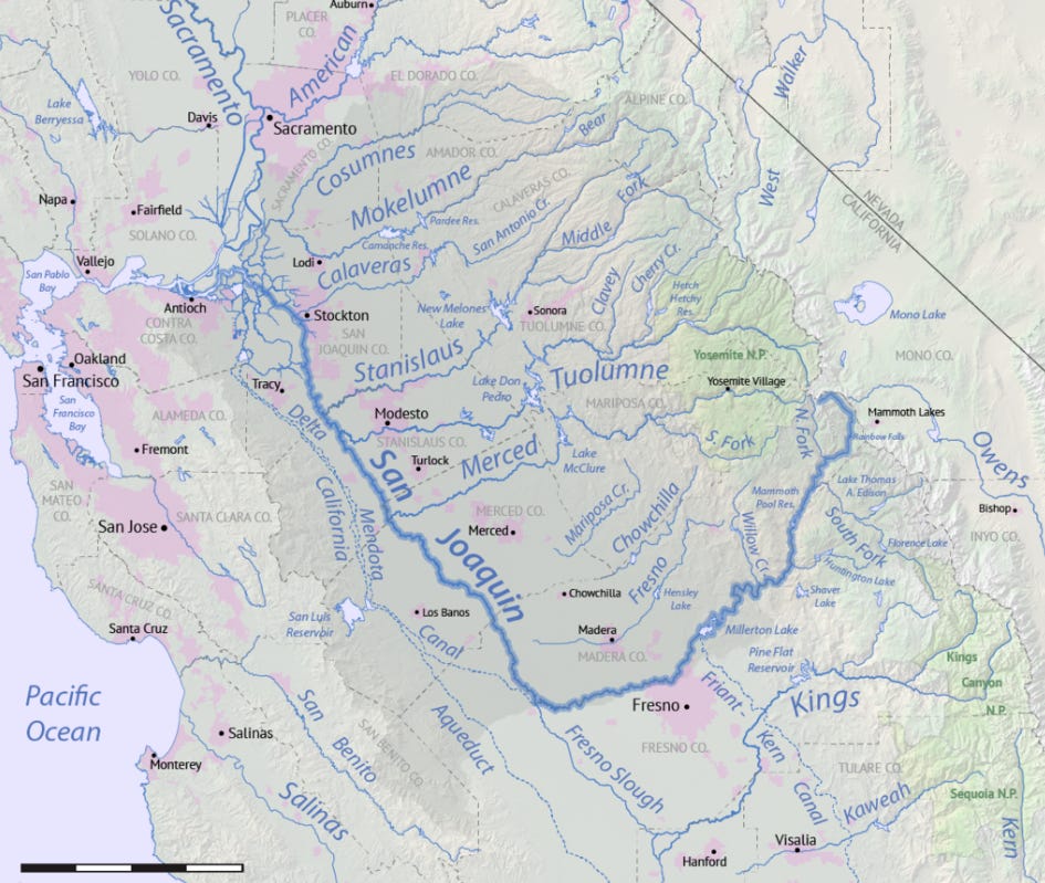
The Sacramento River and its watershed (shown below) flows about 400 miles from northern California towards the south before flowing to towards San Francisco Bay. The watershed covers 27,000 square miles.

The San Joaquin River flows southwest from the Sierra Nevada mountain range towards Fresno, then makes its way northwest towards the Sacramento-San Joaquin delta where it merges with the Sacramento River. The river is approximately 300 miles long, and the watershed covers approximately 16,000 square miles.
The water systems in California are very complex. Aqueducts and canals have been built to divert water all over the state. For example the California Aqueduct, at over 400 miles long, carries water from the Sacramento-San Joaquin delta to San Joaquin Valley and other places in southern California. A description of the complex network of canals, aqueducts and tunnels in California is beyond the scope of this article but for more information, click here for a good place to start.
Central Valley itself does not get a lot of rain (5 to 20 inches per year or 13-51 cm) so most of the water comes from rain and precipitation in the surrounding mountains. Since so much of the water that supplies these rivers is diverted to major urban centres1 and the water demand in Central Valley is so high (mainly due to irrigation), groundwater has been used excessively for many decades.
The main crops in Central Valley include cereal grains, hay, cotton, tomatoes, vegetables, citrus fruits, tree fruits, nuts and grapes (over 250 crops in total, with an estimated value of $17 billion per year). Central Valley covers less than 1% of farmland in the USA, but supplies 8% of its agricultural output (by value) and produces 25% of the nation’s food.
Is Central Valley running out of groundwater? It’s important to know that Central Valley is a basin, so it operates almost like a big bathtub.

If groundwater pumping exceeds the rate that water is recharged, the basin will eventually dry out. It’s also important to know that in California, groundwater provides about 30% of the state’s water supply. However, in droughts, that increases to over 60%, thus illustrating the importance of groundwater.
Groundwater is being depleted in Central Valley and researchers have shown that the rate of groundwater depletion has accelerating since 2003.
In 2014, California introduced the Sustainable Groundwater Management Act (SGMA) with the goal of providing a regulatory framework to evaluate and assess groundwater sustainability plans (GSPs) that are required at the local agency level. The state will provide assistance to locals with development of best management practices. As of 2022, the California Department of Water Resources (DWR) had completed 20 basin-wide assessments within the San Joaquin Valley. As work progresses, the state will be investing over $100 million for continued data collection and monitoring, data analyses and support.
So there is hope for the people of California. The state is well aware of the issues with groundwater in Central Valley and is taking action. Whether or not this action can prevent further depletion of groundwater in Central Valley remains to be seen.
Thanks for reading The Water Droplet and keep watching for more stories about water!
Recommended reading: This article discusses the SGMA and how it may or may not help the issues in Central Valley. https://www.nature.com/articles/s41598-023-41379-9
The Sacramento and San Joaquin Rivers provide drinking water for over 25 million people, including parts of San Francisco and Los Angeles
hola Steve, thanks for writing this piece about the Central Valley water issues. I am working to update the issues with the adoption of SGMA in the Tulare Lake Basin. It does not look promising to properly address groundwater overdraft and land subsidence. let's stay in touch, gracias, ricardo