


Watersheds of the Americas - Part 8

Since late 2024, I’ve been using open-source software (QGIS) to visualize open-source hydrology data. This has allowed me to create maps of networks of streams to represent watersheds. This article is part 8 in an on-going series of articles where I present these visualizations.
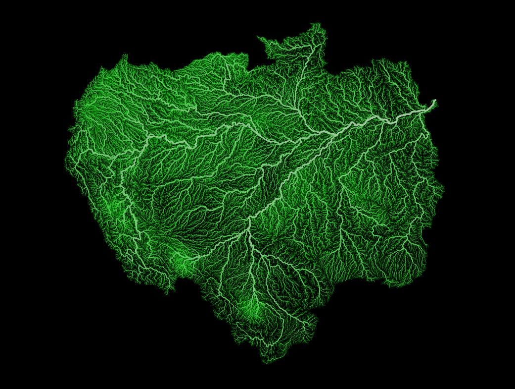
For this article, I’ve visualized the three largest watersheds in the Americas, by area1. The first is that of the Amazon River. Through the support of online tips with QGIS2, I’ve learned some new mapping tricks. The Amazon River in South America has its headwaters near the west coast of South America in the Andes Mountains (at elevations over 20,000 feet above sea level (over 6,600 metres above sea level). The river drains into the Atlantic Ocean after traveling about 4,000 miles (6,400 kilometres), making it the second longest river in the world. The Amazon watershed covers an area of about 2.4 million square miles (over 6 million square kilometres), making it the largest watershed of any river in the world.
It has been estimated that the Amazon River discharges an average of 200,000 cubic metres (2 million litres) of water into the Atlantic ocean every second, which is the largest discharge of any river in the world.
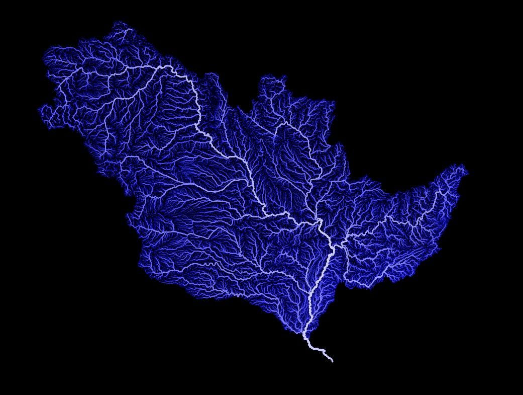
The second watershed, shown below, is that of the mighty Mississippi River, in the USA. At over 4,000 miles in length (about 6,000 kilometres), the might Mississippi River is the fourth longest river in the world. The Mississippi River watershed covers over 1 million square miles (over 3 million square kilometres), which is about one-third (33%) of the entire land mass of the continental United States. The northernmost area of this watershed actually extends into Canada.
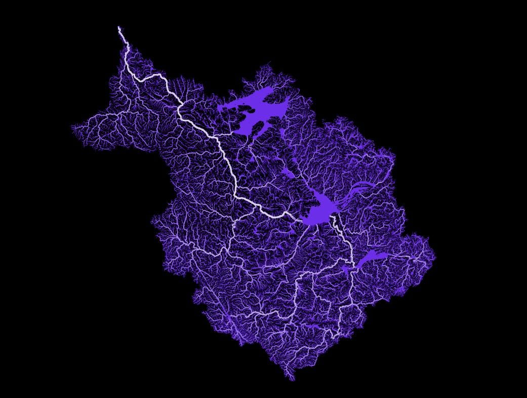
The third and final watershed is that of the Mackenzie River in northwestern Canada. Its total length is over 2,500 miles (more than 4,000 kilometres) and its drainage area covers 700,000 square miles (1.8 million square kilometres), which represents the biggest watershed for a river in Canada and the second biggest in North America, behind the Mississippi River. The headwaters for the Mackenzie River include rivers in the west and southwest that originate in the Rocky Mountains as far south as the town of Jasper, Alberta. In the east part of the watershed, two large lakes, Great Slave Lake to the south and Great Bear Lake in the north are shown as the large purple areas in the map below.
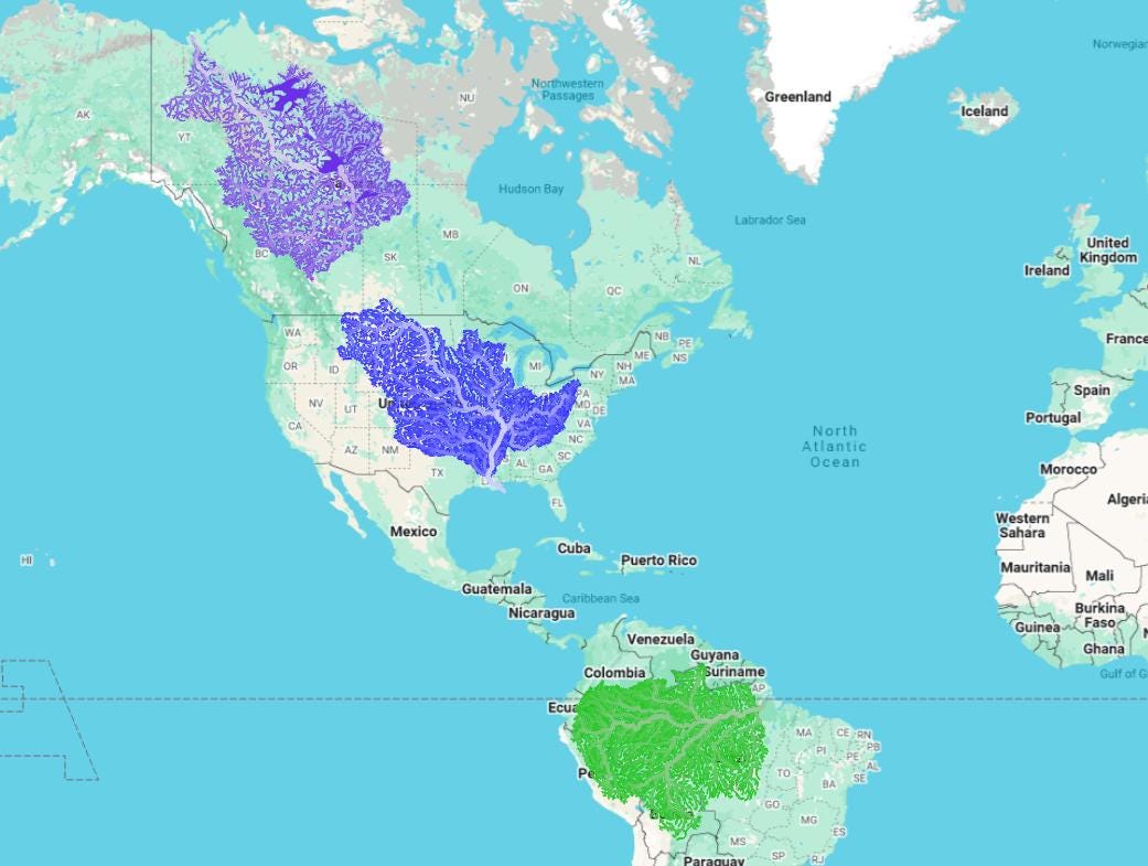
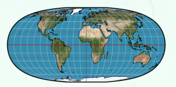
All three of these watersheds are shown on the map below. Note that the size of the three watersheds is distorted because the earth is a sphere, but we’re projecting the surface of the sphere onto a two-dimensional, flat surface3. In reality, the Amazon basin is double the size of the Mississippi basin, which in turn, is nearly double the size of the Mackenzie basin.
Thanks for reading the Water Droplet! Stay tuned for more interesting articles on water. To get email notifications of new articles, enter your email here, to subscribe:
The largest watersheds in the world are the watersheds of the oceans. In this article (and previous articles in this series), I refer to river watersheds.
Mashford Mahute’s LinkedIn account has provided tremendous tips in QGIS.
The projection of maps is something that cartographers have been thinking about for centuries. Modern-day software does map conversions automatically, but it’s important to remember that maps get distorted because of the spherical shape of the earth and when we project this spherical surface to a flat map (either on paper on the computer screen), these mapped objects can be out of proportion. More information can be found here: Mercator Projection: Why Flat (2D) Map Of The World Is Wrong And Distorted?. From that link, you’ll see the image below. Notice how Russia looks huge in comparison to the continent of Africa (and how Greenland also looks so big compared, the USA, for example. That’s because of how the map is distorted.

There are literally dozens of different ways to project maps (see this link, for examples). Some projections end up with maps that look like this:
So interesting. Part of my job involves helping people understand water — and pay more attention to it! This helps me. Would love to see the Delaware River watershed, a river I dearly love and live beside.
Amazing