Subwatersheds of the Grand River Basin
At approximately 280 km, the Grand River is the fourth-longest river in the province of Ontario (and the second-longest river that lies entirely within Ontario). The Grand River watershed covers approximately 7,000 square kilometres and includes the cities of Kitchener-Waterloo, Cambridge, Guelph, Brantford, Fergus, Elora, Paris and Six Nations of the Grand River.
Headwaters of the Grand River are around the town of Dundalk at an elevation of approximately 525 metres above sea level, and the mouth of the river is at Lake Erie at Port Maitland (about 174 metres above sea level).
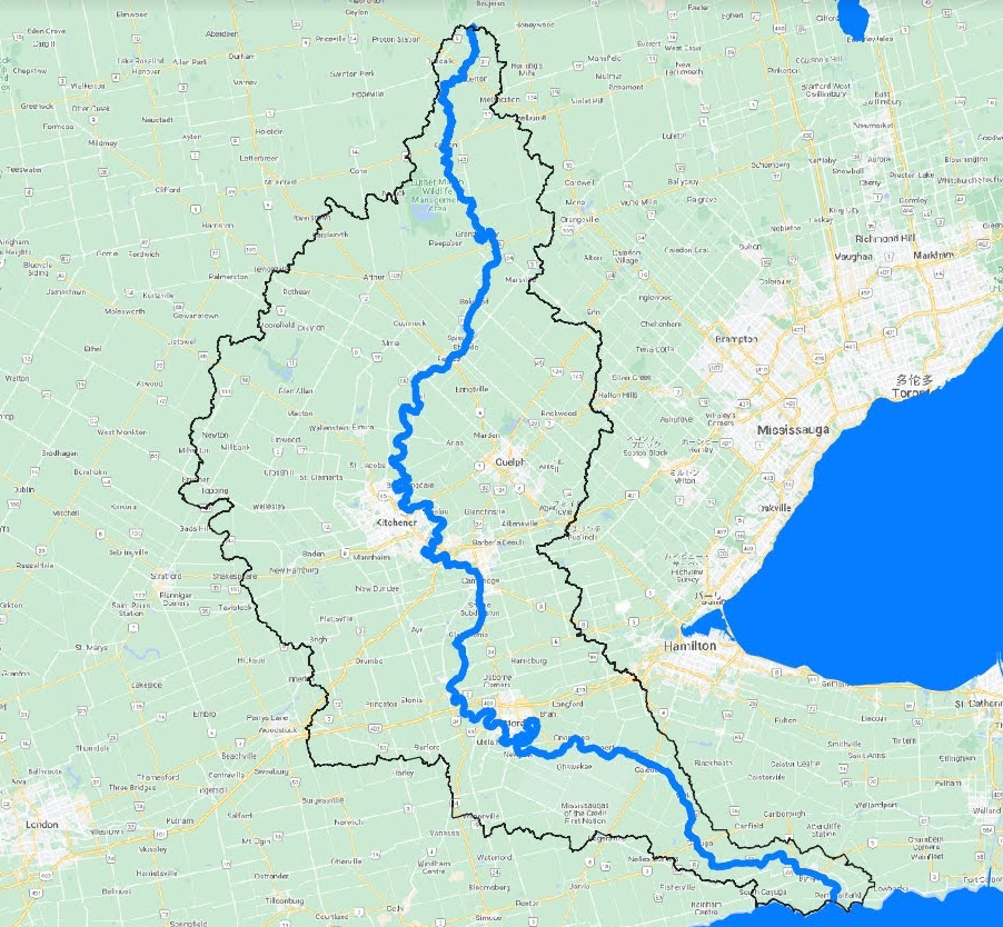
A few months ago, I wrote an article about watersheds where I discussed the watersheds of the Great Lakes. The Grand River watershed is actually a subwatershed of the Lake Erie watershed, which in turn, is a subwatershed of the Great Lakes watershed, which is a subwatershed of the St. Lawrence River watershed!
For the purposes of this article, I’ll refer to the Grand River (sub) watershed simply as a “watershed”. Smaller watersheds within the Grand River watershed will be referred to as subwatersheds.
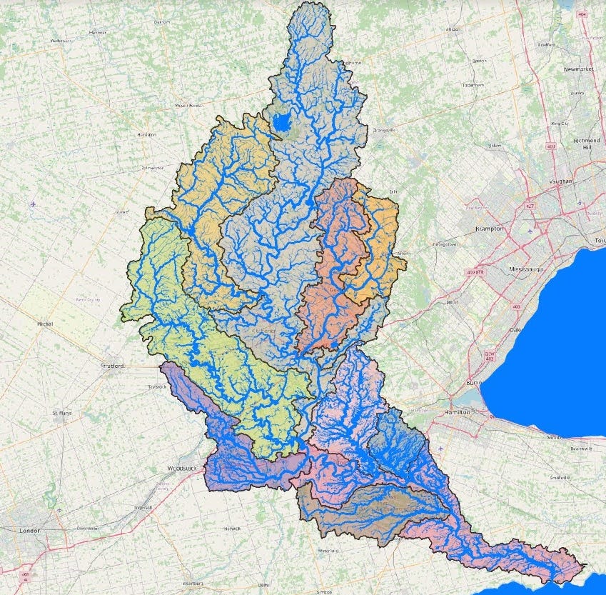
To start, I’ve divided the Grand River watershed into eleven subwatersheds, as depicted in the map below:
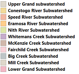
Each subwatershed is depicted by a different colour, as noted by this colour legend:
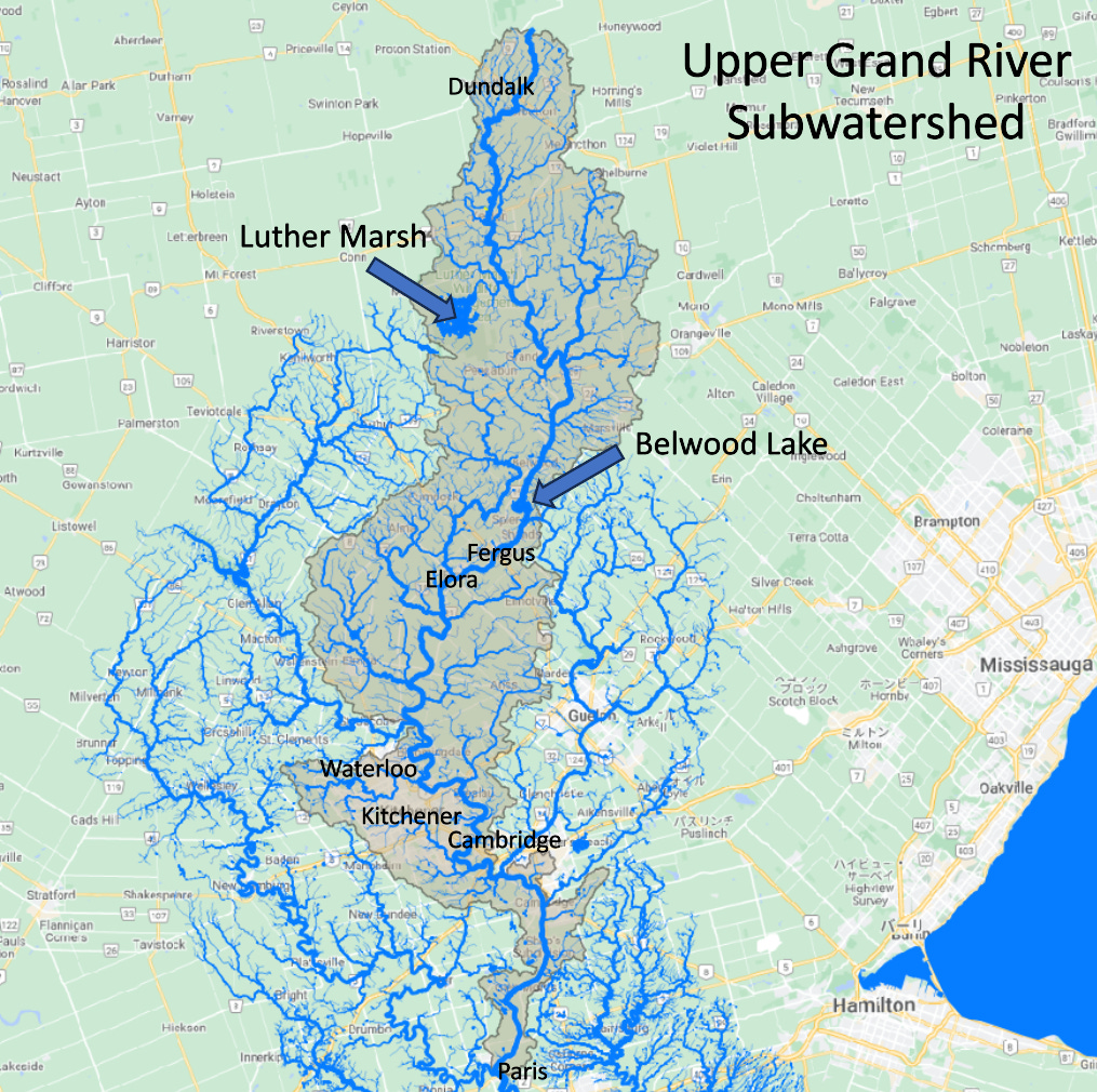
Starting in the north, the grey area is the Upper Grand River subwatershed, which includes the headwaters of the Grand River near Dundalk, Ontario. In this subwatershed, the Grand River flows north to south. Luther Marsh (the larger blue area in the north part of this watershed) was created by the Luther Dam, which was built in 1954 for flood control.
This upper part of the Grand River flows through the villages of Fergus and Elora. Just north of Fergus, the Shand Dam provides flood protection. This dam was built in 1942 and Belwood Lake formed after construction. This watershed ends near the town of Paris, Ontario where the Nith River flows into the Grand River.
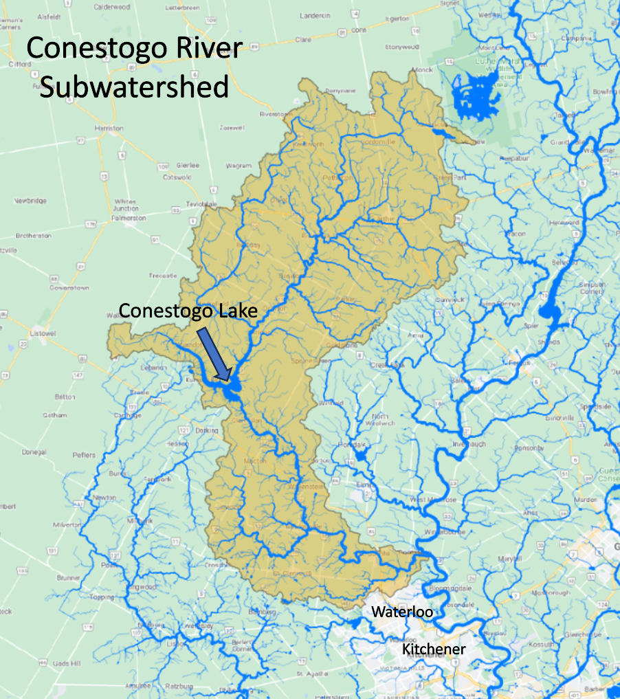
In the northwest, the Conestogo River subwatershed starts near Luther Marsh and ends in the town of Conestogo where this river flows into the Grand River. In the middle of this subwatershed, Conestogo Lake was formed by the construction of the Conestogo Dam, which was built in 1958. The Upper Grand subwatershed includes the Waterloo Moraine, which is an important geologic feature that was formed during periods of glaciation in the past. This moraine is an important recharge feature that allows precipitation to get into the groundwater system, which provides water (via pumping wells) to the cities of Kitchener, Waterloo and Cambridge.
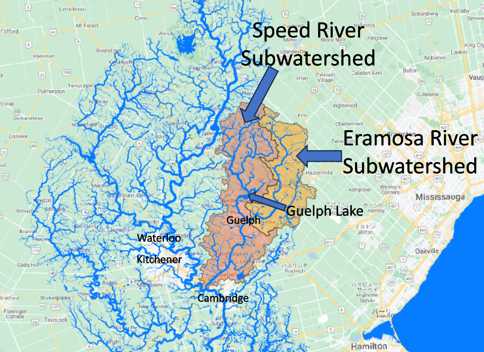
East of the Upper Grand River lie the subwatersheds of the Speed and Eramosa Rivers (see below). The Eramosa River is a tributary of the Speed River and the two rivers converge in the city of Guelph. The larger Speed River then continues until it flows into the Grand River in the city of Cambridge.
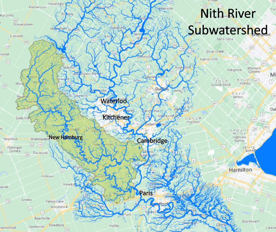
West of the cities of Waterloo and Kitchener, the Nith River flows through the village of New Hamburg (which has had flooding issues in the past) and drains into the Grand River in the town of Paris. The headwaters of the Nith River are just south of Conestogo Lake.
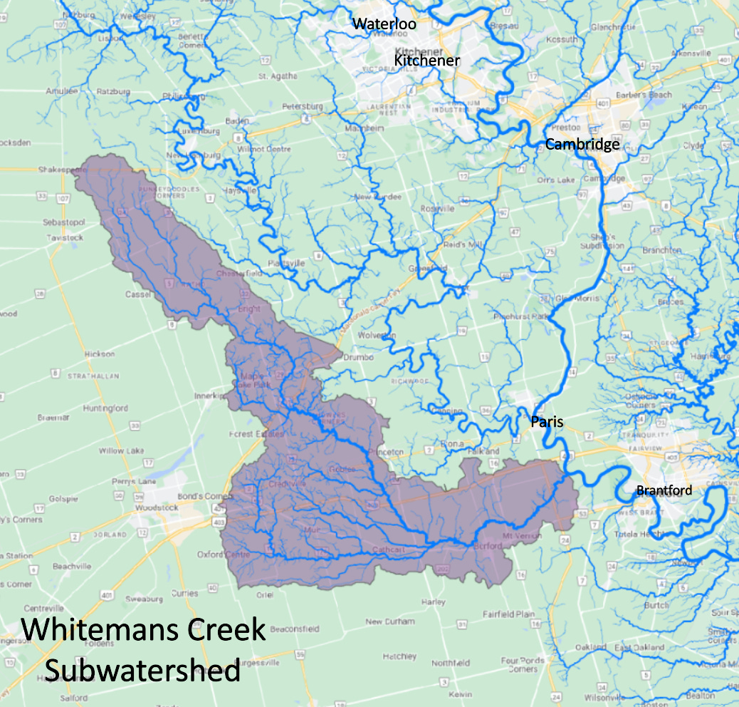
South and southwest of the Nith River, Whiteman’s Creek flows northwest to southeast and drains into the Grand River between the towns of Paris and Brantford.
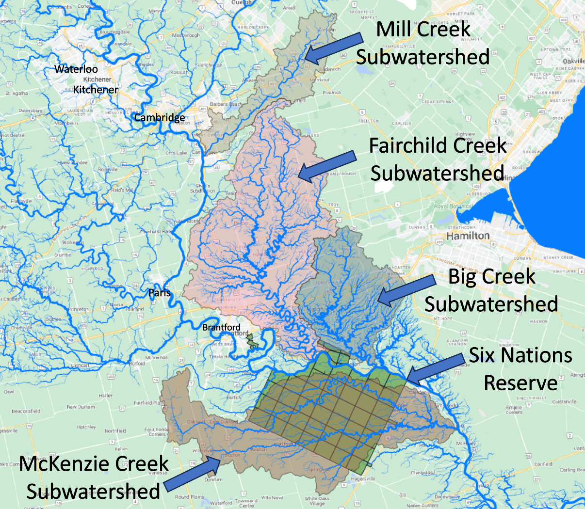
The next map shows four subwatersheds. Mill Creek flows northeast to southwest and discharges to the Grand River south of Cambridge. Fairchild Creek flows north to south and flows into the Grand River southeast of Brantford, Big Creek flows south/southeast and flows into the Grand River west of Caledonia, while McKenzie Creek flows west to east through the Six Nations Reserve1 and flows into the Grand River near York.
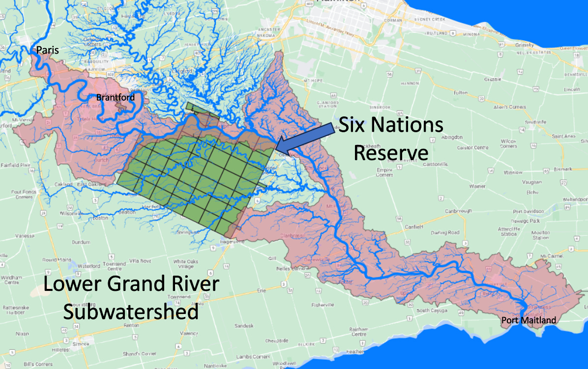
The southernmost watershed is the Lower Grand subwatersheds, which has been mapped to start at Paris, Ontario. The Grand River flows southeast through Brantford, the Six Nations Reserve and eventually flows south and southeast to Port Maitland at Lake Erie.
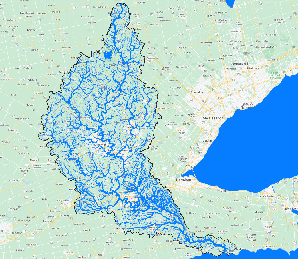
It’s very important to understand our watersheds because it helps us plan for water use, flooding and development. Stream networks, similar to the one shown below for the Grand River watershed, are, in my opinion, quite beautiful. They resemble trees (branch and root systems), or our circulatory system or our lungs!
Thanks for reading The Water Droplet and keep watching for more stories about water!
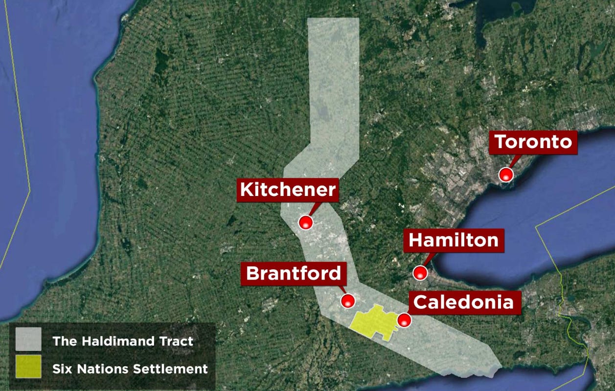
The Haldimand Tract (from the Haldimand Treaty, 1784) runs 6 miles on both sides of the length of the Grand River. This tract of land which was approximately 950,000 acres, was promised to the Six Nations people in 1784. Today, only 48,000 acres remain for the Six Nations. See below (reference here).


